ArcGIS: Esri၏ အလုံးစုံ ပြီးပြည့်စုံသည့် geospatial platform
ArcGISသည် ပထဝီဝင် အကြောင်းအရာတို့၏ ဒေတာများကို ပေါင်းစပ် ချိတ်ဆက်ပေးသည့် Enterprise software ဖြစ်သည်
Esri's MOOC Program
လုပ်ငန်းနယ်ပယ်အမျိုးမျိုးအတွက် geospatial thinking နှင့် ဘက်ပေါင်းစုံမှ စဉ်းစားတွေးနိုင်စွမ်းကို အထောက်အကူပြုမည့် open online courseများ
တိုးတက်ပြောင်းလဲလာသည့် ပြည်သူ့အကျိုးပြုလုပ်ငန်းများ
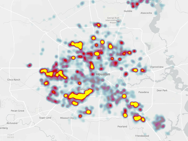
Houston Public Worksသည် GIS software, AI, mobile appsနှင့် real-time dataတို့ကို ပေါင်းစပ်၍ အခြေခံအဆောက်အအုံစီမံခန့်ခွဲမှုလုပ်ငန်းများကို ဒစ်ဂျစ်တယ်စနစ်အဖြစ် ပြောင်းလဲခဲ့သည်။ တိုက်ရိုက်ခြေရာခံခြင်းနှင့် အခြေအနေအရပ်ရပ်ကို စောင့်ကြည်နိုင်သည့် toolများသည် လုပ်ငန်းလည်ပတ်မှုစွမ်းအားနှင့် အရေးပေါ်တုံ့ပြန်ချက်များကို အားကောင်းစေသည်။
တောမီးလောင်ကျွမ်းမှုကိုမြေပုံများဖြင့်တုံ့ပြန်ကယ်ဆယ်ဆောင်ရွက်ခြင်း
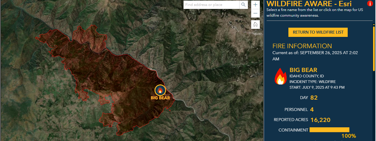
Californiaတောမီးလောင်ကျွမ်းမှုသည် ပိုမိုများပြားပြင်းထန်လာသည်နှင့်အမျှ ပြည်နယ်မီးသတ်ဌာသည် GIS mappingကို အသုံးပြု၍ အဆိုပါခြိမ်းခြောက်မှုကို တိုက်ဖျက်သည်။ အချိန်နှင့်တပြေးညီ အန္တရာယ်တည်နေရာပြ မြေပုံရေးဆွဲခြင်း၊ ဆုံးဖြတ်ချက်များအတွက် ကူညီခြင်းနှင့် လုံခြုံရေးအတွက် အစီအစဉ်ချမှတ်ခြင်း၊ အနာဂတ်အတွက်ပြန်လည်ကုစားခြင်းတို့အတွက် GIS softwareသည် CAL FIREအဖွဲ့ဝင်များနှင့်အတူ တည်ရှိစေသည်။
Trending Insights
RESILIENCE
Denverမြို့တွင် ရေကြီးရေလျှံမည့် နေရာများကို မြင့်တွေ့နိုင်ခြင်း
Esri Blogတွင် story ကို ဖတ်ရှုနိုင်ပါသည်။
Contact Us

for Information- info@esrimm.com
for Technical Support & Licensing - support@esrimm.com

Hot Line:
+95 9 886366874


